


Geology and geosites
At the edge of the ice - a world-class ice age landscape in UNESCO
Global Geopark West Jutland
Across the West Jutland Geopark lies the main ice sheet, where the ice stopped its advance during the last ice age, approximately 20,000 years ago.
North of the main residence line, the ice created the hilly moraine landscape at the Limfjord. South of the main residence line, in the ice-free area, the flat meltwater plains open up with scattered hill islands.

Geosites in Geopark West Jutland
Geosites are specially selected areas that are examples of the unique geology found in the geopark.
Below you can see the 48 geosites in Geopark Vestjylland.
Holstebro Municipality

Burlund
Erosion scarp at the northern boundary of the Skovbjerg hill island, late-glacial meltwater erosion, the Storå meltwater plain

Græm Klint
Cliff profile with ice age layers. Postglacial dune.
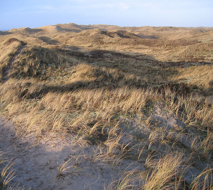
Husby Dune Plantation
Husby Dune Plantation is a plantation area with coastal dunes and parabolic dunes, located on the west coast south of Nissum Fjord.

Hellegård Tunnel Valley
Tunnel valley with thresholds and basins.

Idom River and Ormstrup Heath
Idom Å and Ormstrup Hede is a river valley and heath area located between Holstebro and Ulfborg.

Jutland Reef and the underwater landscape
Flooded glacial landscape affected by marine erosion and deposition. The continuation of the Main Stationary Line in the North Sea.

Linde Bakkeø - Sir Lyngbjerge
Hill island section in extension of the moraine land behind the Main Residence Line.

Nissum Fjord
Nissum Fjord is a coastal lagoon with marine foreland formations such as marshes and salt marshes as well as a river delta.

Nygård Garden
Coastal cliff with deposits from several ice ages.

Ryde - Sevel
End moraine from a re-advance with strongly modified landforms.

Salshøj – Sønderhede
Meltwater plain in front of the meeting between two lobes in the course of the Main Residence Line.

Sdr. Vosborg Heath
Heath with inland sand and parabolic dunes on a hill island.

Sevel Limestone quarry
Abandoned limestone quarry and ruins of limestone ovens.

Storådalen
From meltwater valley to postglacial river valley.

Stubbergård lake - Flynder lake
Tunnel valley. Meltwater valley with kettle holes. Hjelm Heath.

West Coast
Equilibrium and barrier coast. The dynamic coast – coastal erosion and coastal protection.
Lemvig Municipality

Bovbjerg Profile
International Geosite
The Bovbjerg profile is a unique coastal cliff in Geopark West Jutland.

Fabjergkirkevej
The main settlement line and ancient traces with church and burial mounds.

Flynder Å - Klosterhede - Kronhede
The area is a heath plain with two meltwater cones: the Lemvig and Kilen tunnel valleys.

Gjellerodde
Gjellerodde is a coastal area located north of Lemvig. It is a well-developed, mature foreland with a beach lake and sea walls.

Hygum Bakke - Engbjerg Spring
Spring site for extraction of drinking water. Possible marginal moraine complex.
Jutland Reef and the underwater landscape
Flooded glacial landscape modified by marine erosion and deposition. The continuation of the main residence line in the North Sea.

Lemvig Tunnel Valley
Tunnel valley with meltwater cone. The striking valley landscape constitutes a key location in Geopark West Jutland.

Lomborg
The main residence line is among Denmark's most significant landscape elements. It separates two markedly different landscapes.
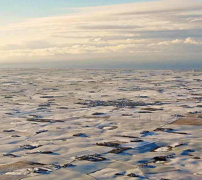
Lomborg - Bonnet - Heldum
Small hilly moraine landscape with dead ice and marginal moraine from the re-advance of the Main Thrust Glacier.

Moborg Bakkeø
Hill island with a profile in a gravel pit and with Møborg Church beautifully located.
Nissum Fjord
Nissum Fjord is a coastal lagoon with marine foreland formations such as marshes and salt marshes as well as a river delta.
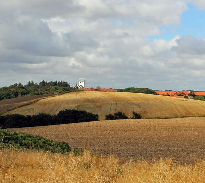
Nørre Lem - Nørre Nissum - Kamstrup
Prominent marginal moraine formed by the re-thrust of the Main Thrust Glacier.

Nørre Nissum - Fabjerg
Small hilly moraine landscape with dead ice between the main residence line and marginal moraine from re-thrust.

Sønder Lem Vig - Geddal Enge
Marine foreland with salt marshes.

Thralborgdalen
Late glacial meltwater valley.

Veserne - Plet - Engbjerg
Raised seabed, Stone Age sea. Littorina escarpment.
West Coast
Equalization and barrier coast. The dynamic coast – coastal erosion and coastal protection.
Struer Municipality

Bjerrumbuen
Prominent end moraine with a strong imprint of ice-lake hills

Bjørndal limestone quarry
Abandoned limestone quarry.

Breinholt Arch
Smaller end moraine and meltwater plain covering an area of approximately 2x2 km just north of Struer.

Fousingdalen
Late- and postglacial meltwater valley.

Gimsing - Handbjerg
End moraine from a re-advance connected to a depression area.

Hellerød Kær
Hellerød Kær is a low-lying marsh area with adjacent pronounced valleys, located at Tambohuse on the east coast of Thyholm.

Hjerm limestone quarry
Abandoned limestone quarry and limestone mine.

Kjærgårdsmølle - Kilen - Hornet
Winding tunnel valley between Venø Bay and Klosterheden.

Odby Ground Moraine
North of Nissum Bredning lies the Thyholm peninsula, which forms the northernmost part of the geopark.

Odby Cliff
Coastal cliff with exposed limestone and flint layers from the Danian and three ice ages.

Oddesund
Oddesund is a coastal area located north of Struer, featuring beach ridge formations, spits, and tombolos.

Remmerstrand - Resen Kær
The Littorina cliff and the raised Stone Age seabed

Skibsted Fjord - Kås widening
The coastal landscapes of the Limfjord represent a great variety of coastal types and forms.
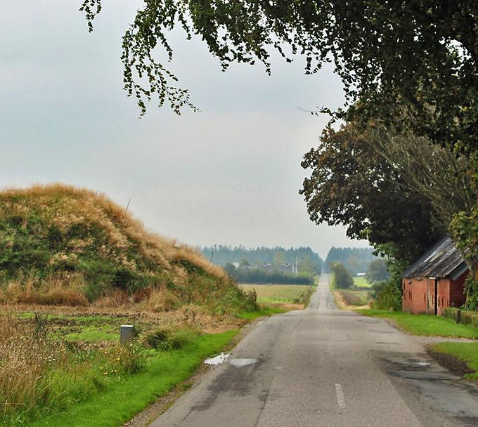
Skodborg Houses
Terminal moraine at the Main Stationary Line west of Hornet.

Søndbjerg beach
Coastal cliff with deposits from the Miocene.

Toftum Bjerge
Coastal cliff with deposits from several ice ages.

Venø Bay
Depression from a readvance during the retreat of the Main Ice Advance.

Venø - Nørskov cove
Coastal landscape with an angular foreland.