Klosterheden
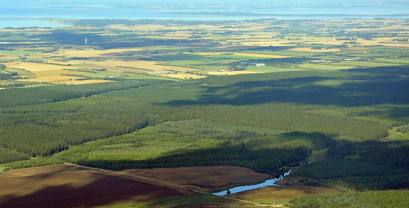
Klosterheden is the common name for both Klosterheden and Kronheden Plantage, which have a total area of 6,400 hectares, making it the third largest contiguous forest area in Denmark.
The area is rich in ancient monuments and contributes to the story of how plants have migrated to West Jutland from the last ice age to the present day. At the same time, Klosterheden contributes to knowledge about the development of wildlife and has the very special story of the reintroduction of beavers in Denmark.
The story
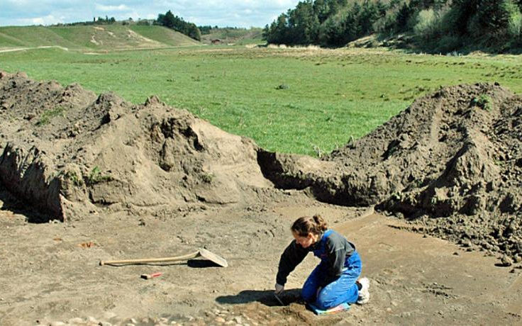
Klosterheden is located on the heath plain just south of the main ice line (see also Geosite no. 20 ). Remains of the meltwater rivers are still very visible elements in the landscape. From around 11,700 years before Christ, low vegetation with herbs and shrubs began to migrate and cover the landscape, and subsequently gave way to trees. The first hunters and gatherers also appeared in their hunt for, among other things, aurochs, moose, wild horses and roe deer and red deer. Klosterheden is today still home to a large population of red deer, estimated at more than 400 animals. From around 4,000 years before Christ, the first cultivation of the land began to take place, and the forest gradually had to give way to fields. Areas in front of the main ice line were particularly suitable for cultivation with primitive tools of the time, and the more than 50 burial mounds from the Bronze Age found in Klosterheden testify that the area has been inhabited since early times. One result of the cultivation, however, was that the soil was exhausted and the heath spread over very large areas.
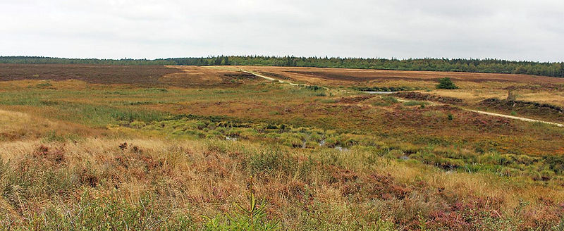
In the Middle Ages, the land belonged to the King and Gudum Monastery – hence the place names Kronheden and Klosterheden – but after the Reformation, the state took over ownership of all the land. In the period up to the end of the 19th century, the area was mainly used for grazing and extensive agriculture, but from 1874 onwards, the state was responsible for extensive planting. By 1896, 6,173 ha of forest had been planted and the populations of deer and a number of other species were growing. Heath gradually became an endangered habitat type in Denmark and in the 1960s, there were only 250 ha of heath left in Klosterheden. This changed, however, when a fire broke out in the plantation on 17 June 1968 and a new heath area of 250 ha was created.
Natura2000 area no. 224 - Flynder Å and heaths in Klosterhede Plantage
The Natura2000 area consists of a total of 563 ha, of which 82%, located in the central part of Klosterheden, is owned by the state. The designation of the area was made on the basis of the occurrence of 16 important habitat types, of which dry heath and watercourses are the most dominant. Otter and brook lamprey are found in the area and are also part of the basis for the designation. The Natura2000 area is managed in cooperation between the Danish Nature Agency, Lemvig Municipality and private landowners, and includes clearing of unwanted vegetation, removal of invasive species, grazing and improvement of the hydrology.
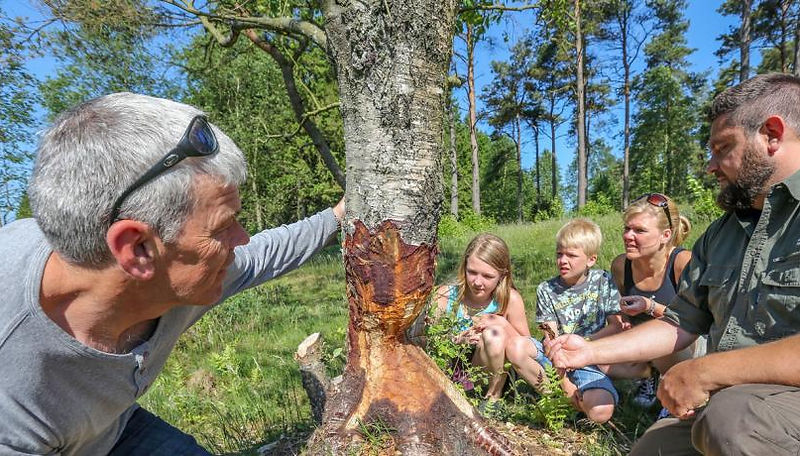
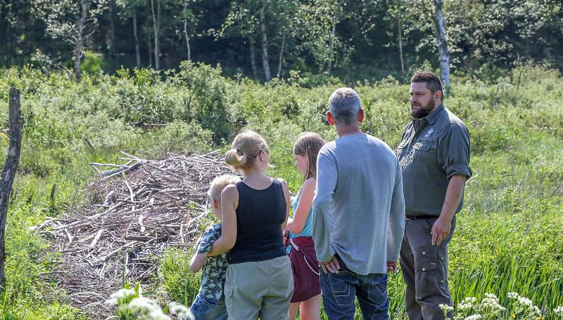
Reintroduction of beavers
The beaver is a native species in Denmark, but it was hunted to extinction during the Iron Age. This was changed in 1999, when 6 beaver families with a total of 18 beavers were released. By 2015, the population had grown to 213 beavers, which have spread over an extensive area. One of the main reasons for reintroducing beavers has been the species' ability to contribute to changes in the landscape and contribute to greater biodiversity.
Rømer's milestone
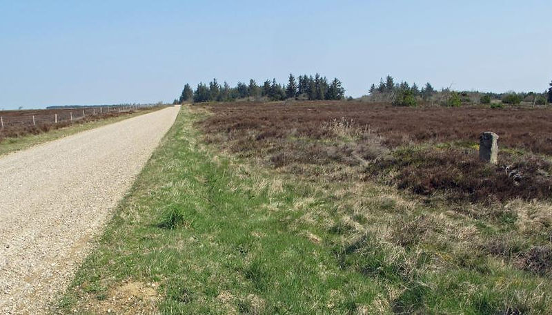
A special feature of Klosterheden are the old milestones along the central road through the plantation, which is appropriately named Gammel Landevej. The road was probably built during the wars of the 17th century, when they were used by Swedish and German troops. In the period from 1691 to 1697, the Danish scientist Ole Rømer was employed to survey the Danish road network. Ole Rømer, who was also known for being the first to measure the speed of light, invented a special surveying cart, a so-called hodometer, and set up milestones every quarter of a mile, several of which are preserved in the plantation.
Collaboration with Geopark West Jutland
The Danish Nature Agency and thus the Ministry of the Environment is a very important landowner and partner in the development of Geopark Vestjylland. The local forester has been a member of the geopark's steering group from the beginning. In Klosterheden Plantage and on several other of the Danish Nature Agency's other areas, recreational trails and outdoor facilities have been created, offering both guided and unguided nature experiences. Among the many popular guided tours are beaver and red deer safaris.